Know the land before you buy it, build on it or plant it.
Draw any piece of land in the lower 48 states. A few minutes later you have a report of 8 to 13 pages on it: where water comes from and where it collects, what the soil will and won't do, when the frosts come, which way the winter wind blows, and what grows there. Tell the map what the land is for and draw your plan, and the report reads the land for those goals and checks the plan too.
One payment, no account. Your report opens at a private link you can keep, print or save as a PDF. Card payments are handled by Stripe. What we keep.
What's inside
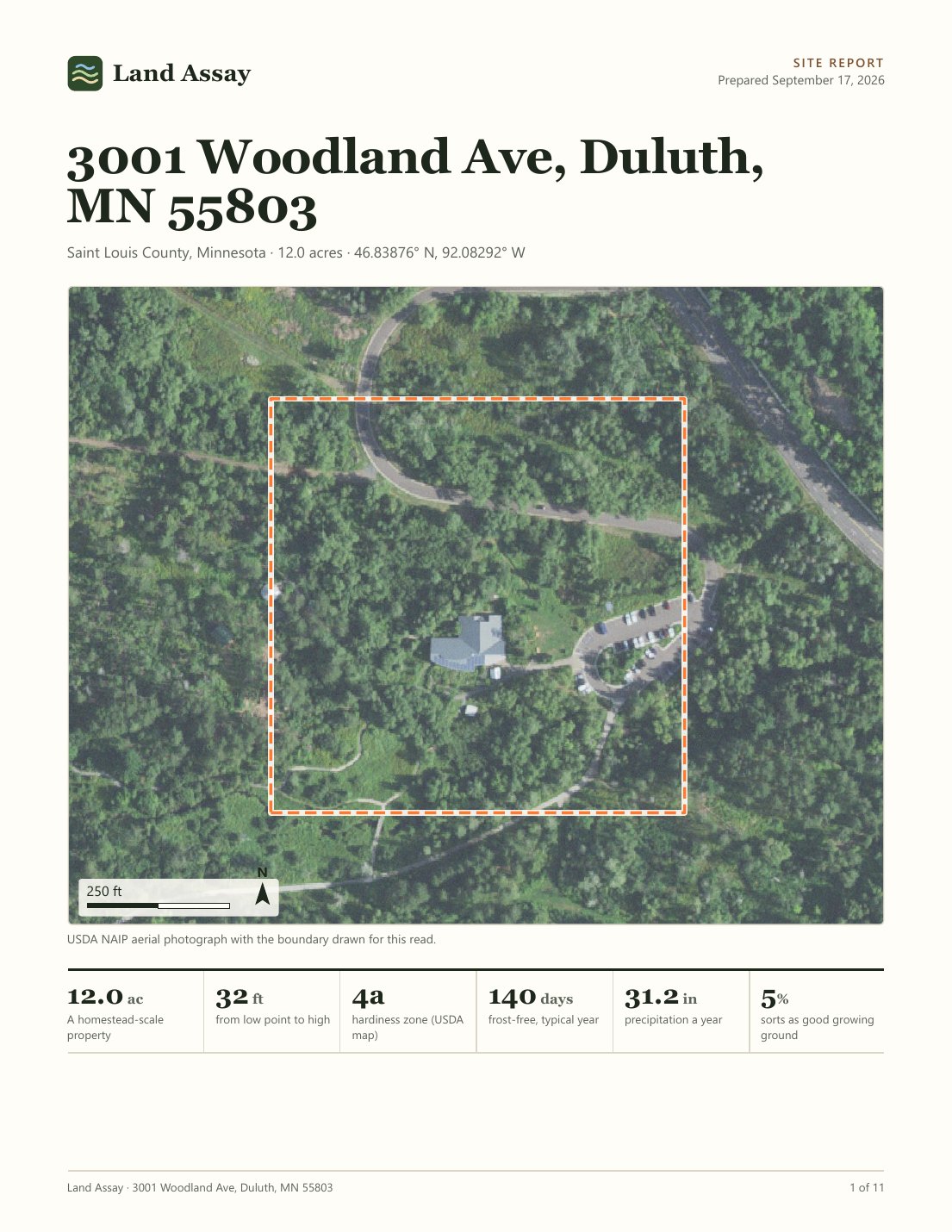
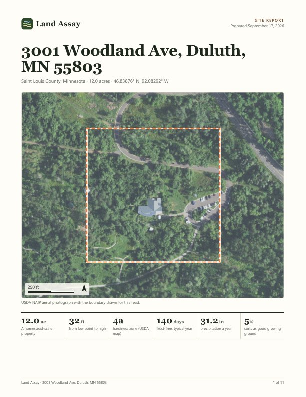
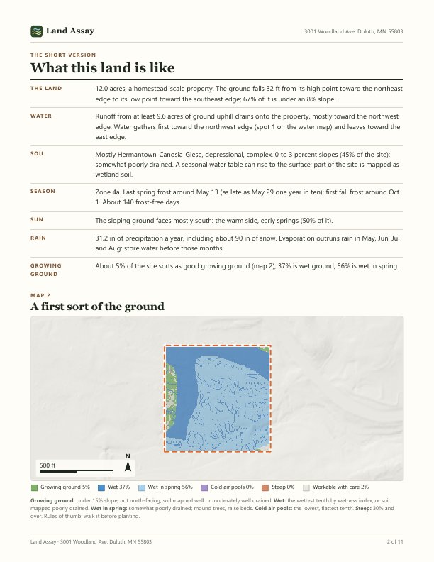
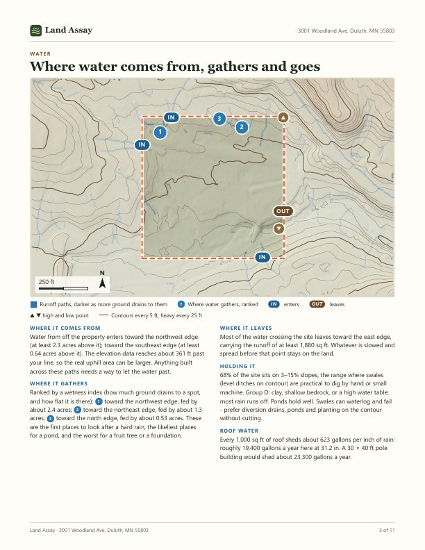
Every page is about your boundary and nowhere else, written so someone who has never read a soil survey can use it. These are the eight pages every report has, from a real one.
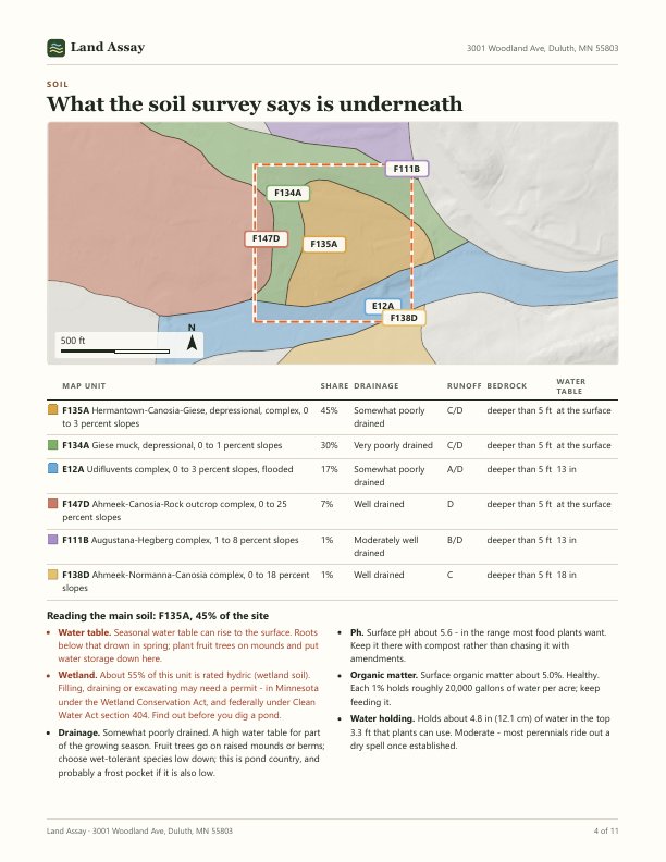
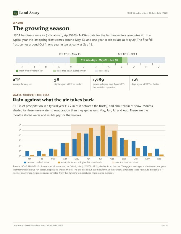
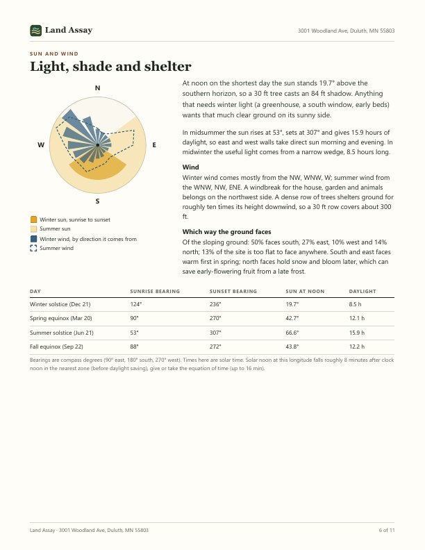
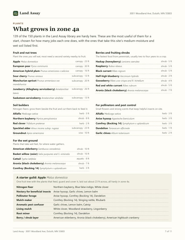
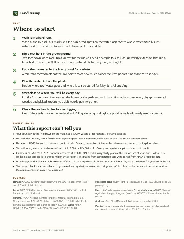
Two more parts come from what you tell the map before you order, and add up to five pages at most: one for your goals, up to three for your design, and the last page can run to two. Skip them and the report reads the land alone. In the sample, three goals were ticked and a small homestead plan was drawn on the site's one strip of dry ground; the site is a public nature area and the plan is invented to show the check at work.
The land, read for what you want from it
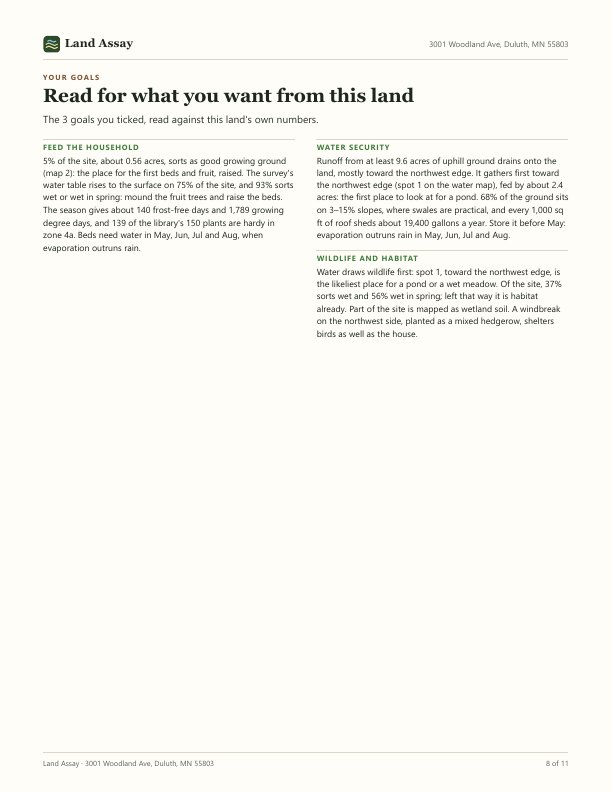
Tick what the land is for on the map's Start tab: feed the household, water security, income, wildlife and habitat, community space, a place to heal and make things, low maintenance. The report gets a page that reads this land again for each one, with this site's numbers: how much of it is growing ground, how long the frost-free season runs, where water gathers and how much a roof sheds, which side the winter wind hits.
Say how far along you are, too. Pick new to this and each goal ends with a place to start. Pick experienced and you get the technical figures: hydrologic soil group, the water the soil holds, contour interval, keypoint elevations and valley grades, growing degree days, 1-in-10 frost dates. The first steps then follow P. A. Yeomans' Scale of Permanence.
Your plan, held against the design principles
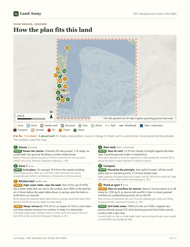
Draw your plan on the map's Design tab before you order. Each element is checked against the same elevation, soil, sun and wind data the report reads:
- Swales on contour, on a slope and soil that suit them
- Diversion drains with a gentle, steady fall that end at a pond or a safe outlet
- Ponds with enough ground draining to them, on soil that holds water
- Garden beds near the house, out of wet ground, frost pockets and shade
- Trees hardy in your zone, suited to the soil, with room to grow
- Windbreaks across the winter wind, on the side it comes from
- Buildings off wet and low ground
- Compost and animal yards that don't drain into your water
- Paths that don't run straight down steep ground
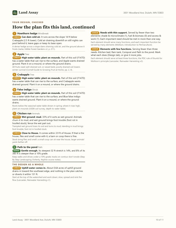
Each one is marked fix, check or placed well, with the measurement behind the mark, on a map of your plan with every element numbered. The plan as a whole is checked too: whether it serves the goals you ticked, whether each need is met by at least two elements, and whether each element does at least three jobs. These are rules of thumb from the permaculture and extension literature, not a site visit.
Read from the surveys, not guessed
Each number comes from a public national dataset, fetched for your exact boundary when you order.
Elevation
USGS 3D Elevation Program: lidar at about a meter where it has been flown, and 10-meter data everywhere else.
Soil
USDA NRCS soil survey, the same maps behind Web Soil Survey.
Climate
NOAA's 1991–2020 normals from the nearest weather station, named in the report with its distance.
Wind
Ten years of daily wind from NASA's POWER project.
Aerial photograph
USDA's National Agriculture Imagery Program, flown every few years.
Plants
A curated library of 150 useful plants, filtered to your USDA hardiness zone and matched to your soil.
How it works
Draw your land
Find the place on the map and trace the boundary. Tick what the land is for, and draw your plan on the Design tab if you have one. It's free, and you can look at the terrain, soils and climate before buying anything.
Type the address and pay
The address you type becomes the title of your report. $49, once, through Stripe.
Open your report
It's built from the surveys in a few minutes and opens at a private link. Bookmark it, print it, or save it as a PDF.
Who it's for
Buying land
See where water sits, how deep the soil is and how long the season runs before you make an offer, not after.
Starting a homestead or garden
Know where the growing ground is, where a pond or swale would work, and where to plant the first fruit trees. Draw the plan, and the report says what to move before you dig.
Selling land
A report in the listing answers the questions buyers of rural land ask first. For several listings at once, write to hello@landassay.com.
What it isn't
- A survey. Your boundary is the line you draw, not the legal parcel line.
- A perc test, septic design or well report.
- A zoning, flood-zone, easement or title check. The county answers those.
- A guarantee for your microclimate. It's the best public data read carefully; walking the land in a hard rain still beats it.
- A designer's plan. The design check holds the plan you drew against rules of thumb; it doesn't draw one for you.
What we keep, and what we don't
- Kept with your order: the boundary you drew, the address you typed, the design, goals and experience level you sent with it, the email address Stripe passes back after payment, and the report itself. They stay so your private link keeps working. A checkout that isn't paid for is deleted after two days.
- Never here: your card. Payment happens on Stripe's page, and Stripe holds the card details under its own privacy policy.
- Your email is used to send you the link if the report isn't ready when you return, and for refunds or questions. No list, no marketing, never shared or sold.
- The link is a private, unlisted address that search engines are told not to index. Anyone you give it to can open it, so share it the way you would share the PDF.
- No account, no analytics, no tracking. The map sets one cookie: a random ID that brings your saved designs back to this browser, with nothing about you in it.
- Want it gone? Write to hello@landassay.com with your link, and the order (with its boundary, design and goals), the report and your email are deleted.
Start with the map
Looking is free. Draw the land, see the terrain and soils, and order the report when you want it written up.
Open the map